Award
2018 Student Merit Award
Site
South Holland, IL
Category
General Design - Undergraduate Project
Landscape Architects
Ziyuan Wu, Maxwell Stuber, Sean O’Connor, Amanda Lerman
Project Details
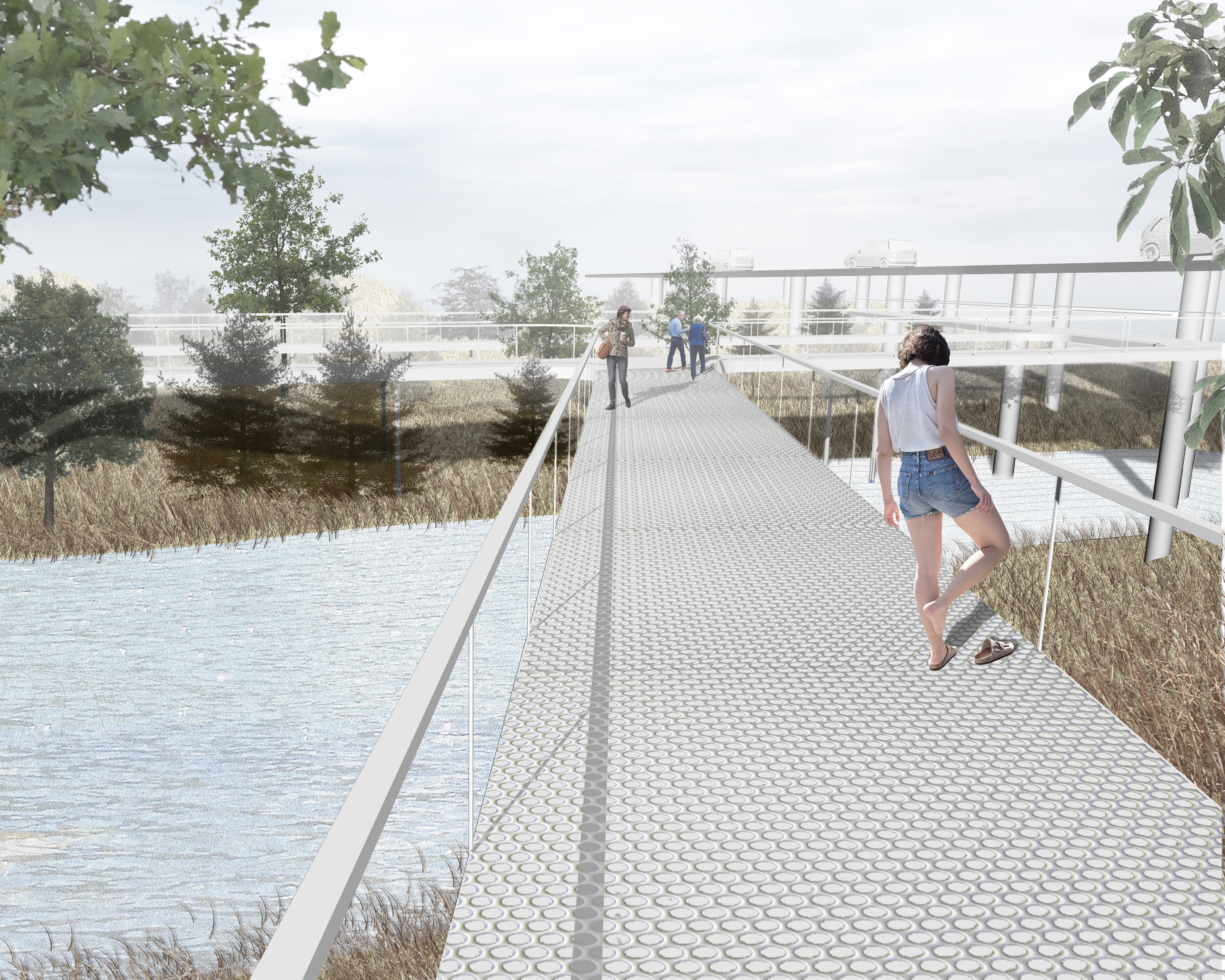
South Holland locates in the South of Chicago and is characterized by its concentration of single family residential community, Route 6 that runs through the entire city, and an issue with flooding. The river in South Holland experience severe flooding which endangers the property in the surrounding, causing it to be detached from the aura of the entire city. The main hope of the design is to reconnect the community to the river and adapt Little Calumet into the identity of South Holland. We also aims to reinforce community identity and establish river identity. The city of South Holland aims at developing its commercial industry through establishing on its already existing cultural history and community unity (identity). The community identity will create branding for South Holland and encourage more people to come and recognize South Holland as a destination.
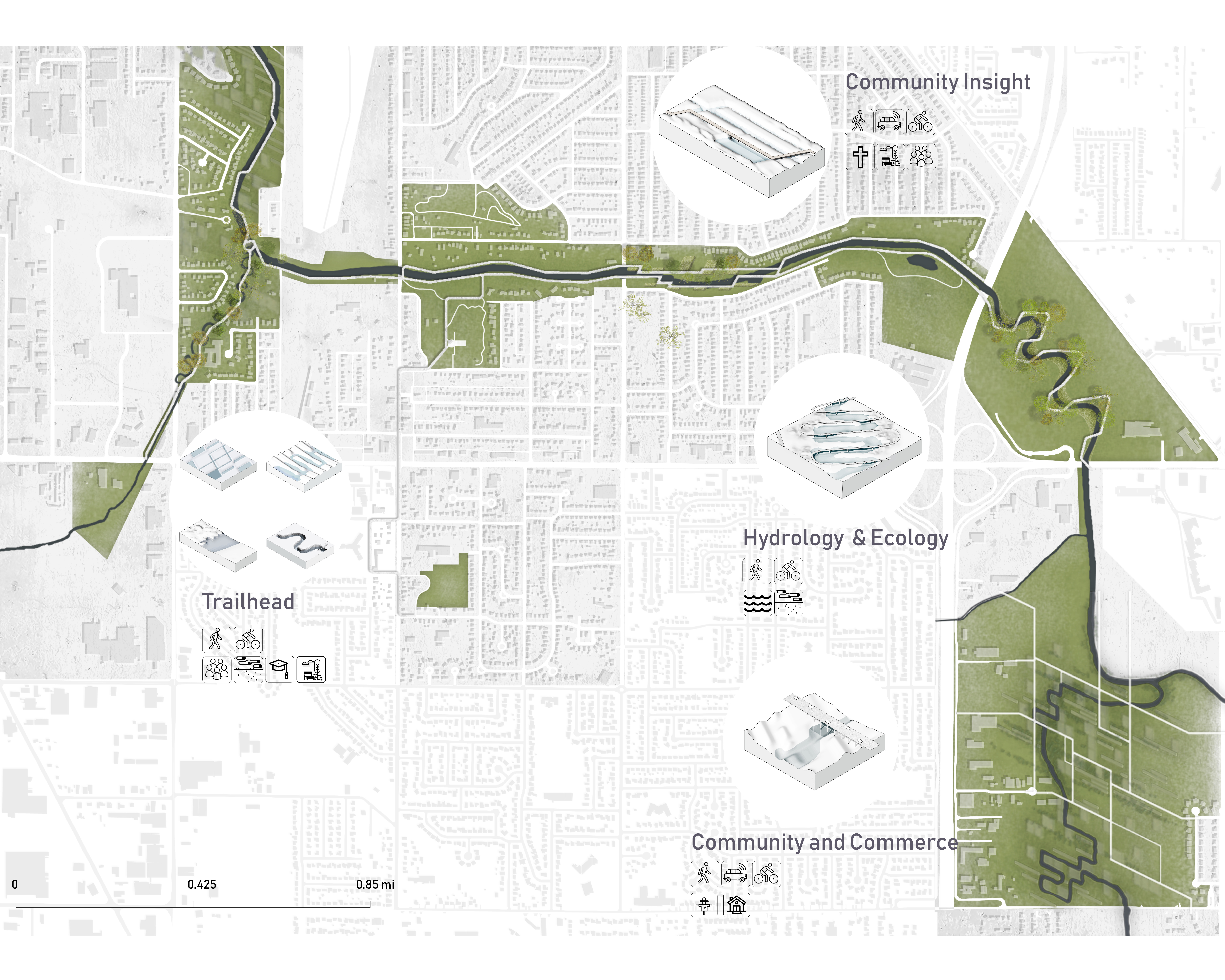
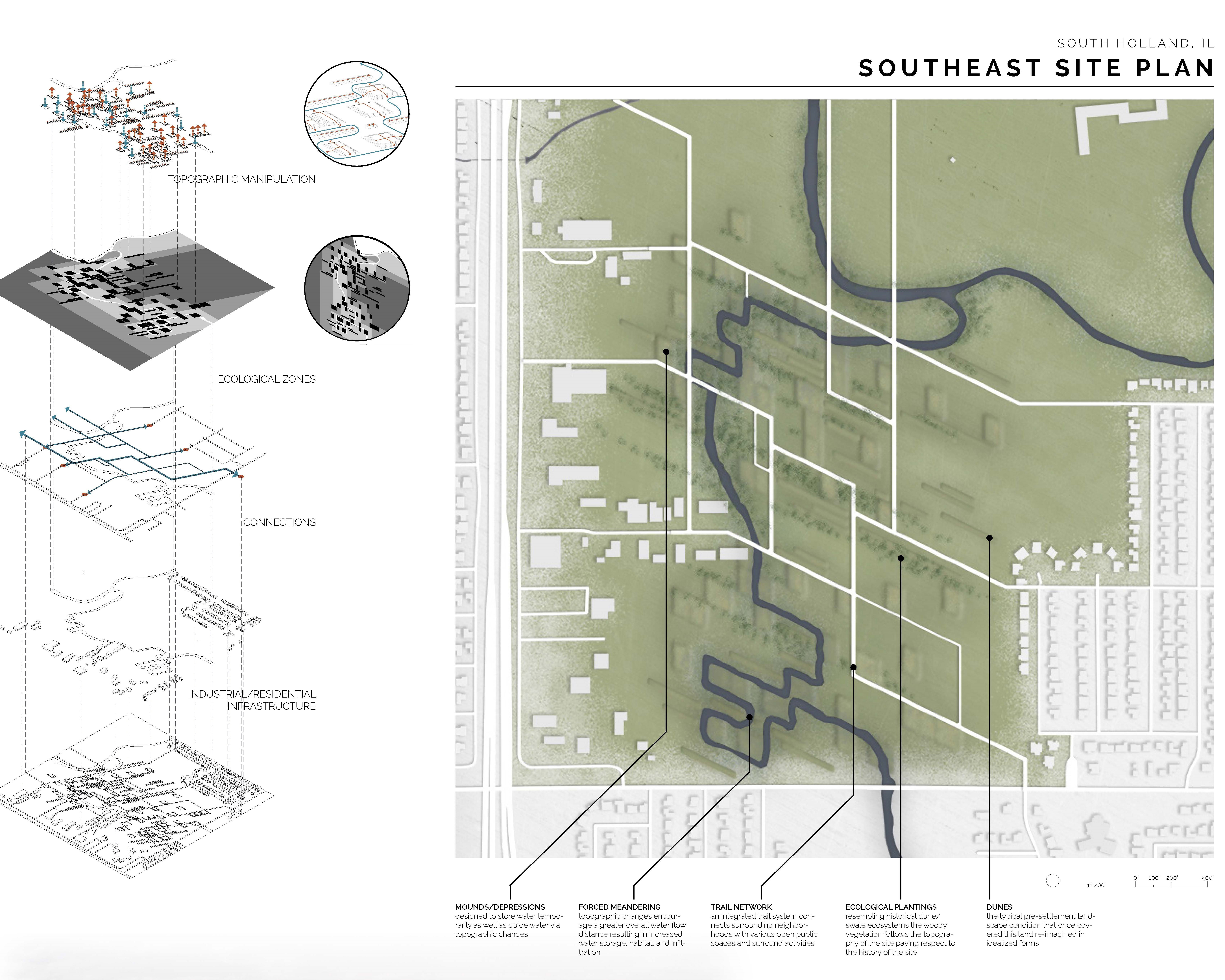
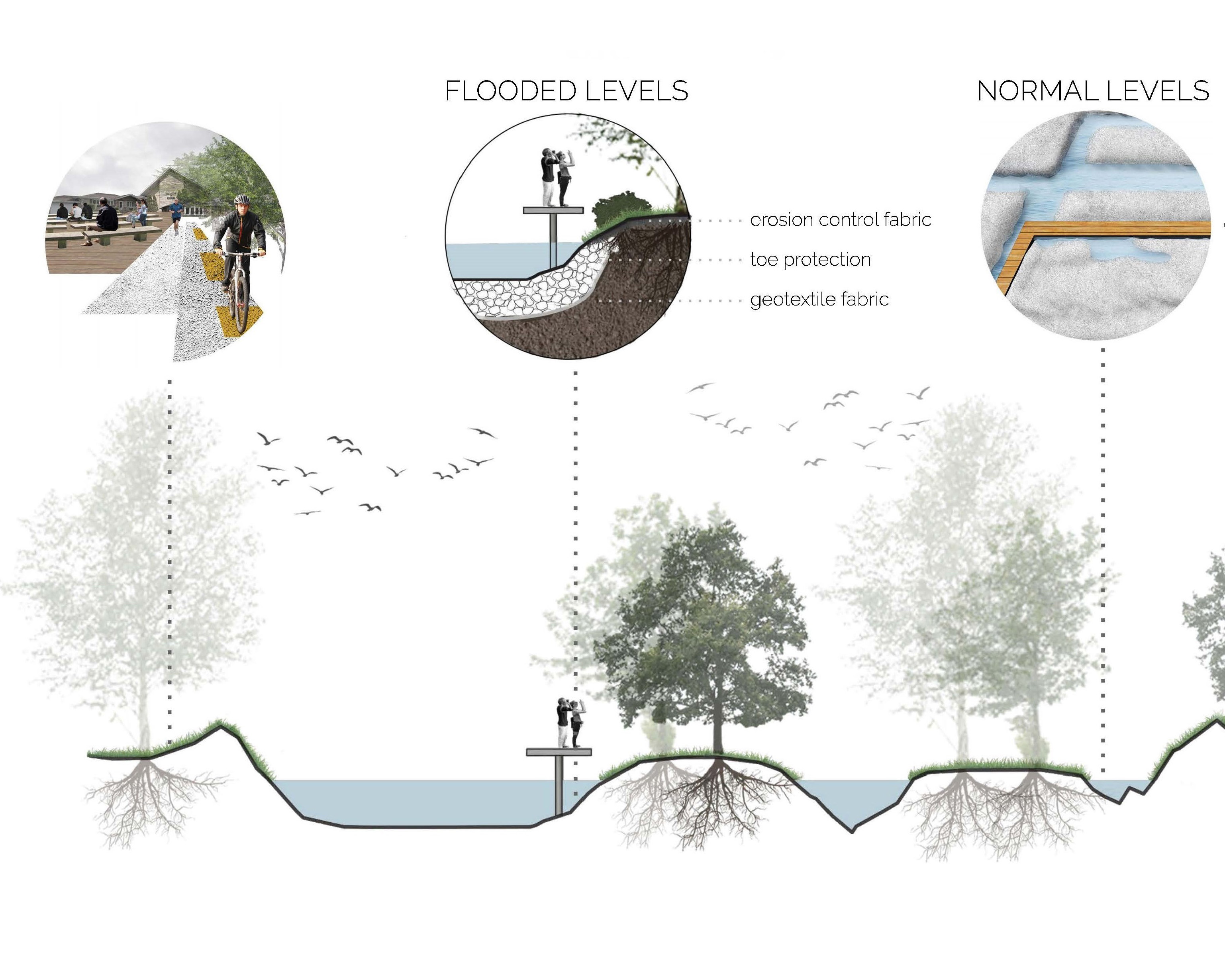
To reconnect the community, we first came up with prototypes to deal with flooding through topographic manipulation. The prototypes will serve as a tool kit that could be implemented beyond the site itself and throughout South Holland after small alterations to fit the exact conditions of the site. Then looking at the site, we selected 4 locations that is typical representation of a kind of condition in South Holland: a mix-use river-fork, a residential space, a vacant land at the outskirt of the city, and agricultural space between the commercial and residential area at a frequently flooded area. To deal with the complex hydrological and geological condition at the site, we combined and modified our prototypes to form new strategies for individual conditions/site. (At similar conditions in South Holland, the same strategy can be applied.) Each strategy will do several of these functions: slowing down the river, increasing water storage capacity, directing river flow, treating runoff, establish diverse planting, and protecting habitat for species. To connect the riparian corridor to the community, the riparian corridor is connected to present parks, bike trails, and churches through a continuous park and trail network. People can access the park through connection points at bus stops, route 6, and bike trail entrances. At different points, visitors experience a different side of South Holland when community life, faith, natural history and hydrology is adapted into the riparian corridor through topography, planning, and programming.
The project deal with native natural phenomenon and test hypothesis to deal with flooding at the local level. Moreover, we create a kit of flood-mitigating strategies that can be applied to site not limited to South Holland. The project is a prototype for targeted flood mitigation through matching site condition to prototype functionalities. Beside treating the basic hydrological disaster, the we open up the river corridor to its community and using it to make South Holland a recognizable destination.


